A rare opportunity to acquire over 266 acres of strategically located land parcels in high-growth Grayson County, spanning Sherman and Howe, TX.
Residential - Sherman Texas
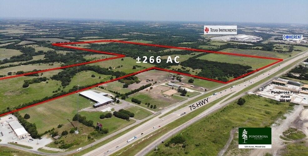


A rare opportunity to acquire over 266 acres of strategically located land parcels in high-growth Grayson County, spanning Sherman and Howe, TX. Situated near Texas Instruments’ new facility, Shepherd’s Place, and the Sherman Gateway development, this portfolio is ideal for residential, industrial, or mixed-use development. With close proximity to major transportation corridors and Howe High School, the location offers strong potential for near-term projects or long-term investment. Positioned in one of North Texas’ fastest-growing markets, this is a compelling opportunity you don’t want to miss. Message us today for details!
Property Type: Vacant land
Lot Size: 266 acres
Property Features
- Land is 266 acres
Residential